
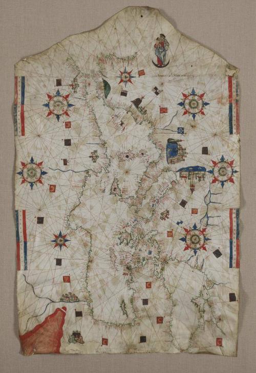

Portolan Chart of the Mediterranean Black Sea, and Atlantic (Finisterre to Cape Nun)
Date1552
MediumInk and color on parchment
DimensionsOverall: 106.2 × 74.2 cm (41 13/16 × 29 3/16")
Frame: 188 × 269.2 × 4 cm (74 × 106 × 1 9/16")
Frame: 188 × 269.2 × 4 cm (74 × 106 × 1 9/16")
ClassificationsPainting
Credit LineNew York, The Hispanic Society of America, K34
Object numberHSA075
On View
Not on view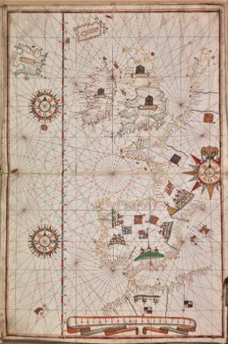

1526


Late 12th-14th centuries